

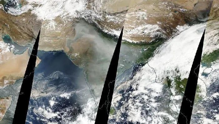
A thick blanket of haze has engulfed large parts of northern India as temperatures continue to drop, with the pollution now visible from space.
Satellite images released by NASA Worldview on November 10 show a dense layer of grey haze covering several parts of the country.
The images reveal that the pollution is most intense across northern India, including Delhi, Uttar Pradesh and neighbouring states. The haze also stretches into the Himalayan regions of Uttarakhand, Himachal Pradesh, and Jammu and Kashmir.
While central and southern India are also covered by haze, the pollution appears to be less severe compared to the northern region.
Western states such as Rajasthan and Gujarat, along with the northeastern states, appear to be relatively free from the thick grey cover seen in the satellite images.
The satellite images come two days after Diwali, when the use of firecrackers typically leads to a sharp increase in air pollution. NASA's images from November 8 also showed Delhi, western Uttar Pradesh and nearby regions covered in a dense layer of haze following the festival.
Meanwhile, Delhi's air quality showed slight improvement on Tuesday. According to data from the Central Pollution Control Board (CPCB), the city's Air Quality Index (AQI) stood at 299, placing it in the "poor" category.
The improvement comes a day after Delhi recorded an AQI of 376 on Monday, which fell in the "very poor" category.